

Interactive Maps
Since each county may have a different mapping system you will need to learn new access and use steps for each of your target areas. Some counties have a GIS man on staff. They are always a great help. Call them.
To proceed with our search example on a site in Utah, we need to find in what county the CLDQ site is located.
- A regular road map identifies that the area is in Emery County.
- Go to the Emery county assessor at http://www.emerycounty.com/assessor/index.htm
- Click on the Department Directory in the red band at the top. Scroll down and click on IS/GIS, which goes to the screen for Online GIS Services.
- On the left Menu click on the heading “Online Maps.”
- Further click through to the heading “Interactive Maps.”
- Still further click through to the heading “Land Owner Info” to the “Interactive Mapping System” Enlarge county image as needed. If you click on the Range and Township under “Plot Information” you get a location grid as a guide.
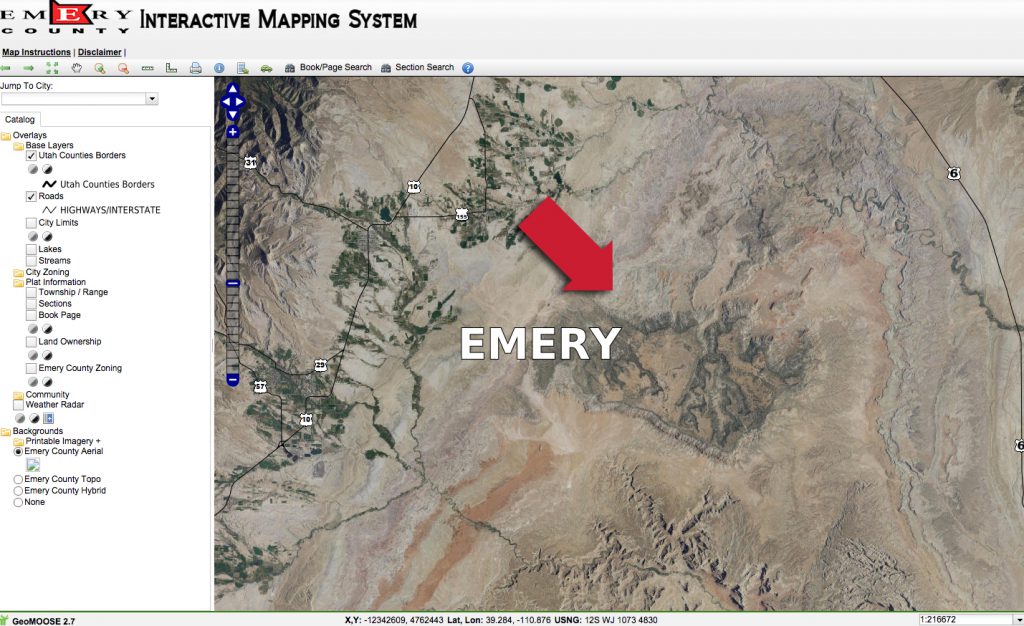
- Click on the Aerial view under Backgrounds and match this image up with the, Geological maps, Google Map images or copies of other area views you found online.
The search can be difficult at this point. As in the manual process, the scale of the map you see will likely be different from the scale of the geology map you may have. Again you will need to manually match up the map scales and overlay one with the other to choose an ownership target. I take a lot of screen shots at different magnifications.
X Marks the Spot 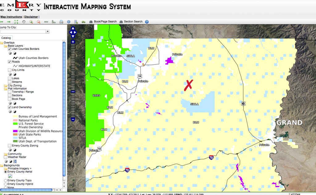
X Marks the Spot 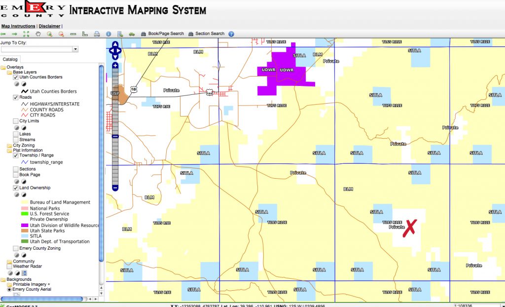
X Marks the Spot
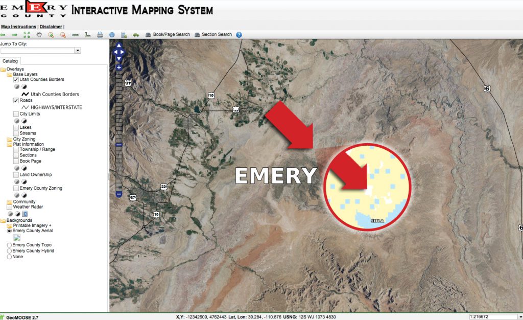
- When you click on Land Ownership the aerial view is replaced with colored squares indicating ownership of each section or parcel as based on the legend on the lower left side. You want to look for “white” areas, which represent “private” land. In this example, there is so much BLM and State land that it is easier to find the white sections and see if they align with any formation targets.
- Identify any white areas that coincide with your target age sediment in this case Jurassic. This example may not have a white area where you want, but It shows you how to find them, here or elsewhere.
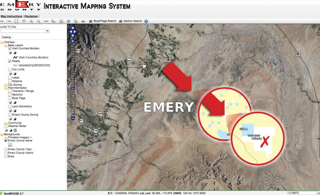
- Go to the top of the interactive map and click on the “ i ” for information.
- Click on the map at the point of interest or within a “White” section.
- Now you want to go back and click on and mark the Book Page in the catalog listing.
Any white public areas will now turn green like the BLM land, which is confusing. But now the left side will show a highlighted ownership “Plot Link” for the location you had chosen.
- Click on the Link and you will see a map of that particular parcel section including the names of the individual or corporate owners.
Not all searches are this complicated, but many are. In one search case the only available parcel information was on a large map on the wall of the assessors office. The clerk there was kind enough to take photos of the map and email them to me. Many counties now have an extensive online parcel finder system available through the county assessors web site. Even these systems can be exasperating and not very user friendly. At times I have become so frustrated I gave upon that area even after calling the assessors office for help. I started all over and changed the search area and land formation just to get to a county where I could understand and use their parcel viewer for ownership information.
I recently subscribed to an online system developed by OnXHunt. See www.onxmaps.com. It is available for lease or rent by the month or on an annual basis. You can subscribe to all states on any particular state. This system was developed for use by big game hunters, but it works equally well for fossil hunters. It provides several map layers including parcel location, size, boundaries and ownership. They have gone through all the work to get the data I find difficult at times to uncover. It is not perfect and still has areas where they state “No data available”, but it is well worth the fees.
Now you know the land owner, and all that is left is to find the phone number for that particular individual and ask for permission to search. Remember this is only a randomly chosen example. Apply the general process to your site of interest until you can complete step 5.
