
In this process you will be working to overlay and match up two sets of data, i.e, surface land geological data with land ownership data. The geological data will come from the state and federal geological maps while the ownership data will come from a local county assessors office.
You will find that each state and each county within a state may have a different manual or online mapping system. Many are similar, but you will need to learn the specific access steps for each different state. It is easy when the county has an online Parcel Viewer System. I found in one key search county, the only map that existed was hanging on the assessors office wall and was updated with only a magic marker. That was it! Fortunately, the nice lady in that office took photos of the map and texted them to me.
This section describes how I go through a location search using data in both manual, or hard copy form or interactive, online form. My examples are a general guide. You will need to fill in the blanks and deal with the differences you find at the location you choose to investigate.
Search Process With Manual/Hard Copy Maps
When I first began years ago there were no interactive map systems for the areas I wanted to search. Only separate parcel and section maps were available. I gathered all the maps I could, and my desk looked like this. So, I did the following:

- I download and printed out copies of the Range and Township Section maps that show the best parcel details for an area covering 4-6 sections or 24-36 miles wide.
- I taped all the Range and Township maps together into a larger composite map (2-3 feet wide) covering the entire area.
- I tried to match this large parcel composite map to the Geological map I had purchased for the same area. The Geological maps often have a larger scale than parcel maps, so when necessary I enlarge the parcel composite map to match the scale of the Geological maps.
- I taped the Geological map to a backlit window and overlay it with the composite parcel map. I aligned the map images to match up the coordinates.
- I then traced the outline edges of my target age exposure onto the composite parcel map. In my case, I traced the boundary edges of the Cretaceous exposures. I then knew which parcels were within my target Cretaceous age exposure.
- I then searched for only those particular landowners.
Search Process With Interactive Online Maps
As an example with interactive maps I just picked a Jurassic age site in UTAH at random. I could show an example in any site in any state. The example area I use may or may not actually lead to a possible site. It is just an example to describe the process I use. I have repeated this process in different areas many times only to find there was no available private land to pursue. You just keep trying.
Finding a Known Dinosaur Site
- Go to Paleobiodb.org and click on US on the world map
- Click on western US and then on and enlarge Utah.
- Select Mesozoic on the time line on the bottom of the map. This will reduce the fossil sites to only those in the Mesozoic.
- Click the “Bug” tab at the left and enter the taxa as Dinosauria
- Next, click on the category again when it is displayed in bold under your entry box. This will reduce to sites to only those with Dinosaur evidence.
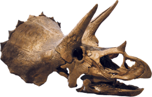
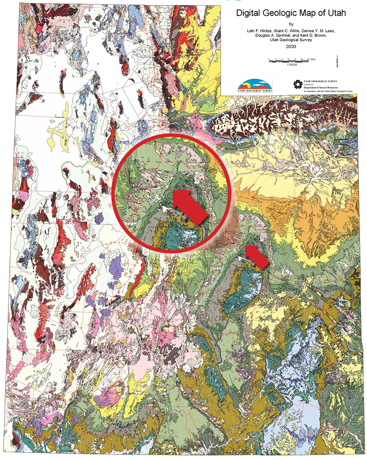
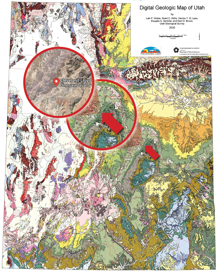
- Choose a known site in the interactive map. For this example site I chose on the map was associated with the Cleveland-Lloyd Dinosaur Quarry (CLDQ) in Southeastern Utah. See the light blue dot at my arrow in the following images. PHOTOS: PBDB 1,2,3. See Google Maps view of the area below.
- Click on this site dot and a new window describes the site as in the Morrison Formation, Brushy Basin Member.
- Click on the heading “Occurrences” and a new window describes the species found there as Stegosauria and Theropoda.

PBDB 1 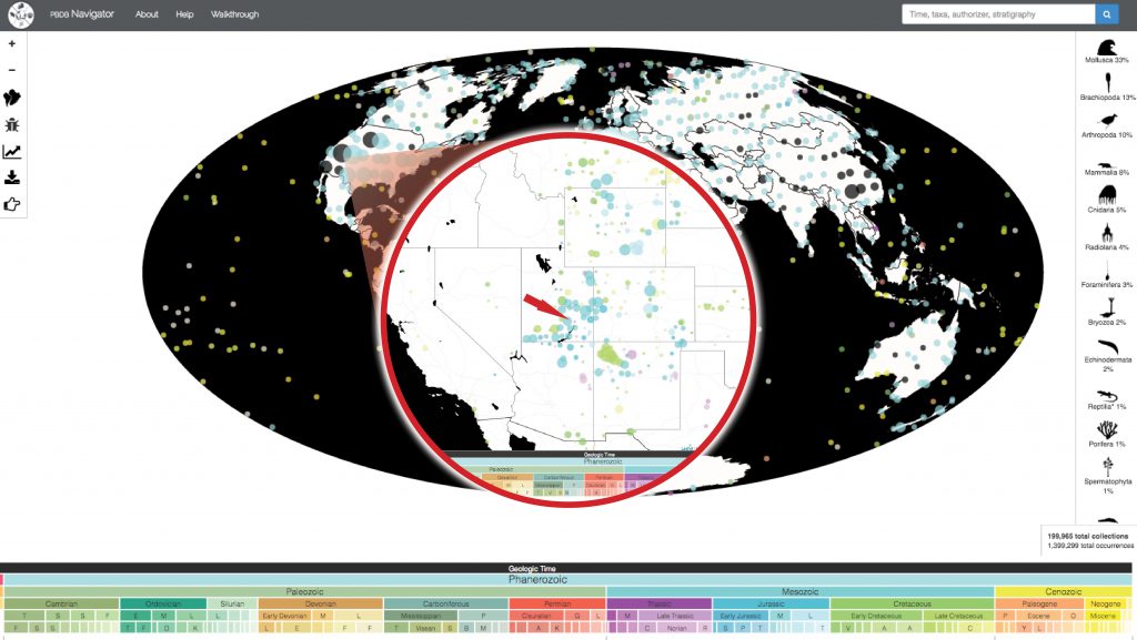
PBDB 2 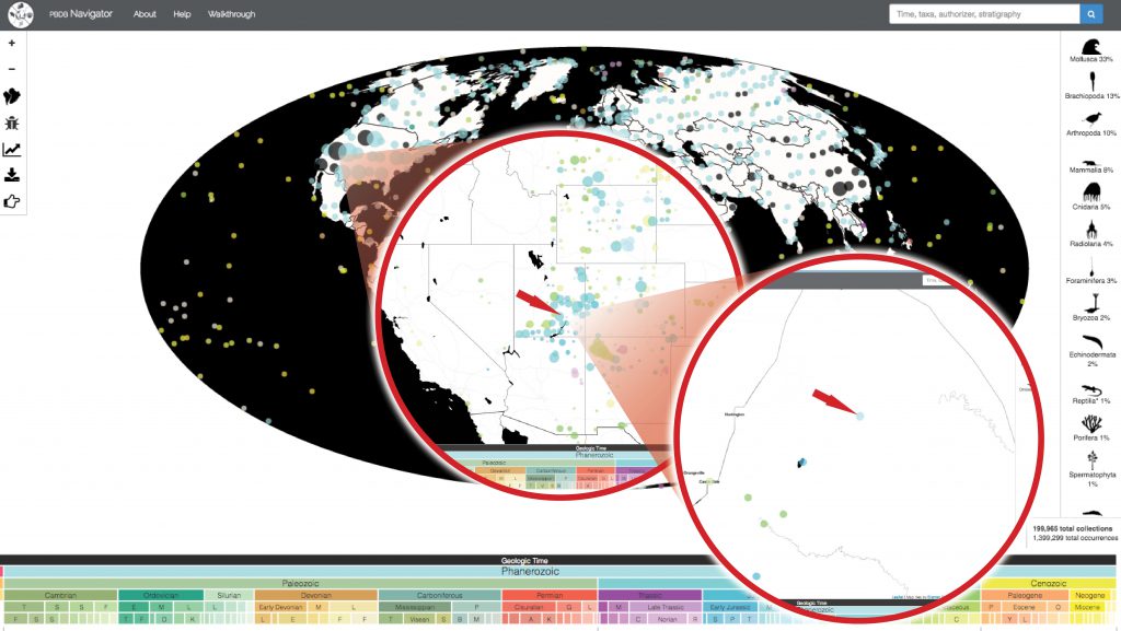
PBDB 3
Finding Extent of the Target Formation
Now we need to identify the extent of the Morrison formation in the area. Does the formation extend beyond the quarry boundaries?
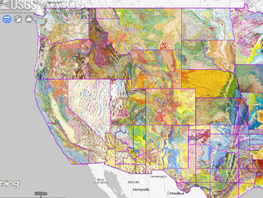
- Go to the best geological database you can find for your area of interest. For the UTAH example start at https://geology.utah.gov/apps/intgeomap/#
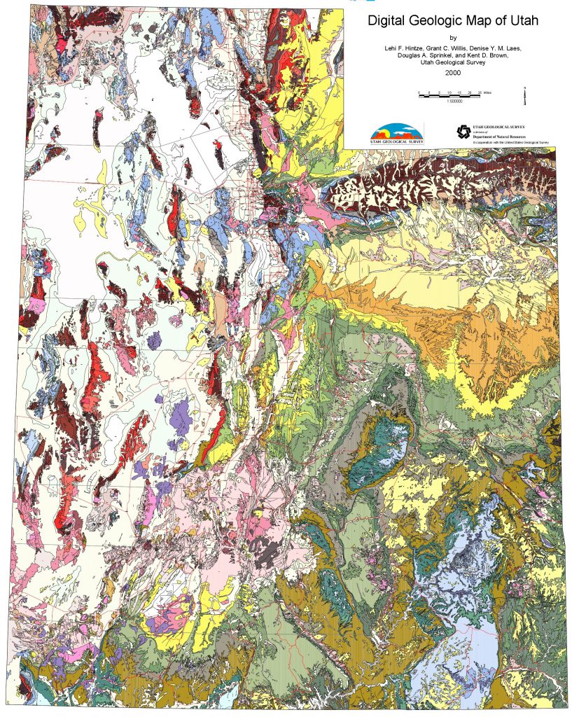
Map of Utah Geology 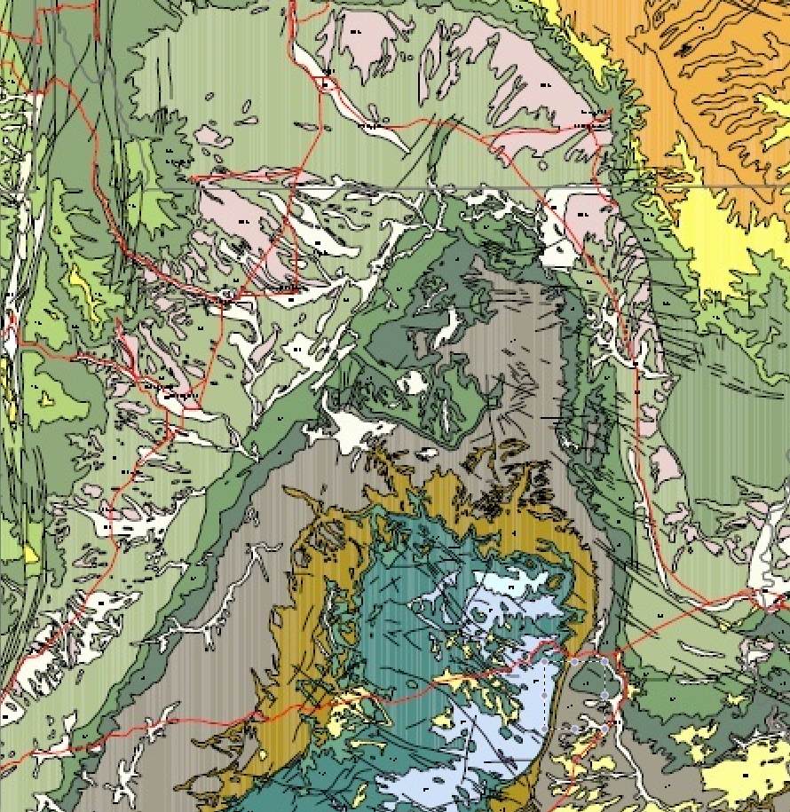
Geological formations in target area 
Aerial view of same formations. Some stand out by color

- Magnify until you see the geological data in the finest detail available for the area. You will see multiple Jurassic and Cretaceous formations near this site. The symbol for the Morrison formation is “Jm, ” You will need to study more about these symbols, because on a different geological map I find the same area was split up as Jm, Jmbb, Jc, Jms, Jsc, Jrs and Js. Which one has the history of fossils?
So now you have the description of the surface land that extends beyond the original site, and you want to find if there is any private land on these formation exposures? Feel free to contact me if you have difficulty going through any of these this stages for the locations you are studying.
