Grids
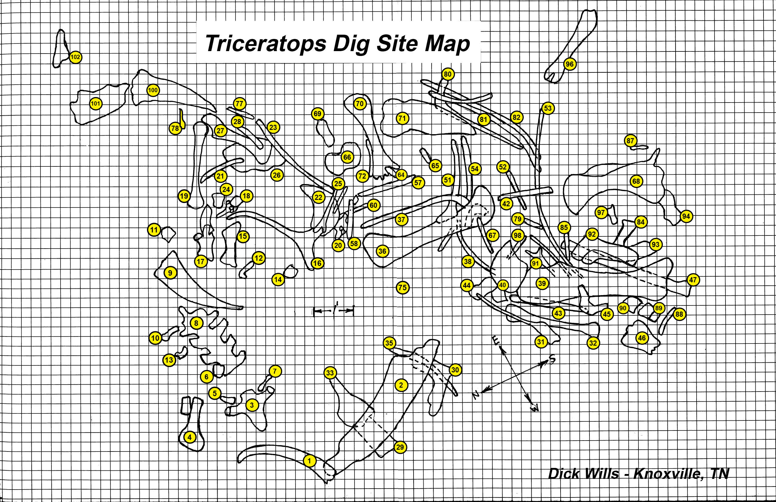
When I have a multi-bone site I make traditional location grids. I always map out a site grid to normal compass lines. I had a Triceratops site that covered about about 250 sq.ft. The bones were packed in close, and my grid was comprised of small 3’x3’ sections.
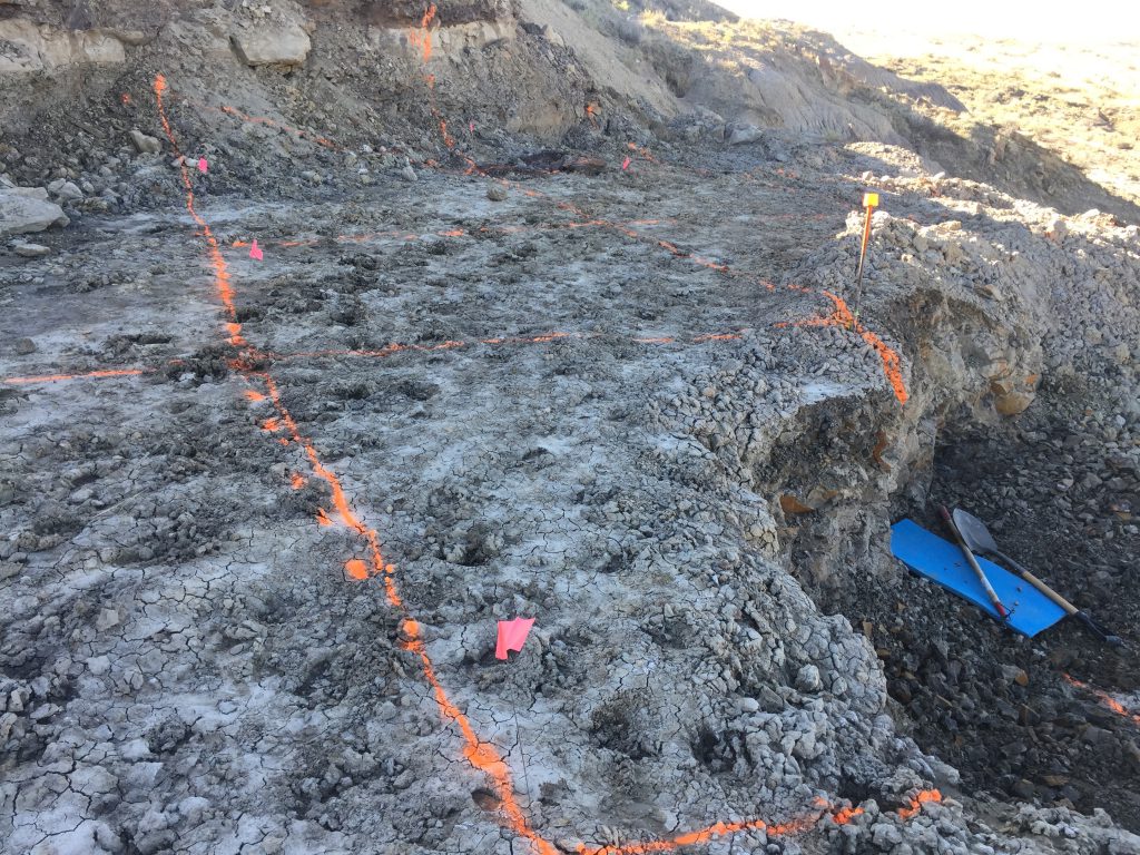
At my largest T-Rex site, I had colleagues who removed over 1000 cubic yards of overburden to get down to the bone layer. This created a flat pad of over 1800 sq.ft. I marked off a 10′ by 10′ grid over the entire pad with fluorescent paint and numbered each corner or line intersection. I also planted small numbered fluorescent flags at each corner. When I found a bone, I documented the location of each end of the bone relative to the nearest two corner flags. Each section can be further divided into smaller grids as needed.
T-Rex Dig Site Grid 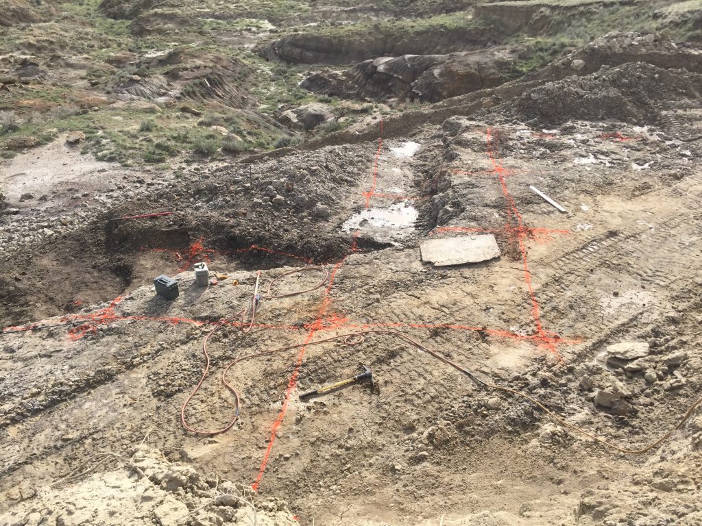
T-Rex Dig Site Grid 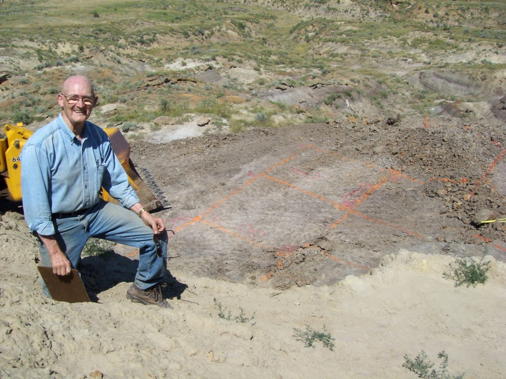
T-Rex Dig Site Grid
Many professionals use a special, very accurate GPS unit to log in the exact location of each area of a fossil bone. The data is transferred to a graphics program which automatically constructs a true site map. I am still in the manual mode and I log the following information on my data collection form.
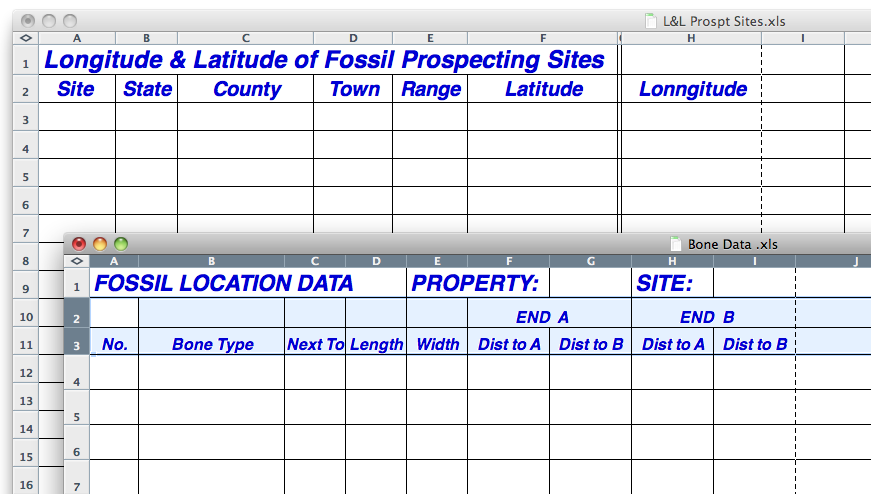
- Code Name for Property
- Site Number within that property
- Bone or fragment Number at that site number
- Bone description (when I recognize it.)
- Bone length
- Bone width
- Adjacent bone Number
- Distance from one end of the bone to grid point A
- Distance from one end of the bone to grid point B
- Distance from opposite end of the bone to grid point A
- Distance from opposite end of the bone to grid point B
Site Map & Photos
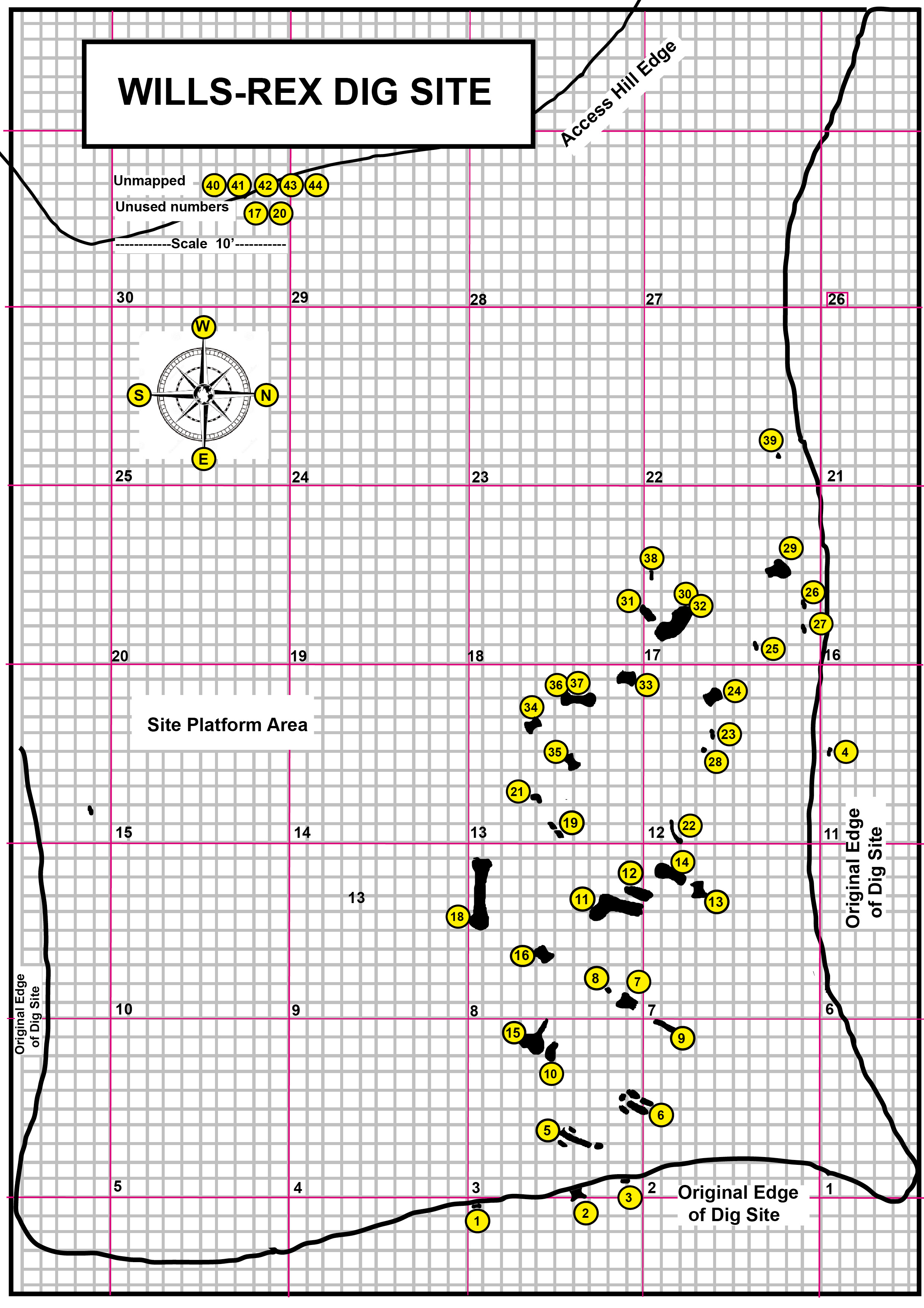
With this data I construct a scale diagram of the site. An accurate site map can help you interrupt (guess) what happened to the original carcass and where additional bones may be buried. These photos show maps of my largest sites.
After working on many sites, the bone images tend to all run together in my memory even with good layout data. So, I try to take a photo of each bone with a scale as a reference along with pictures of overall site and surrounding area. These pictures become invaluable when I want to communicate to others the quality and condition of the bones after they are locked up in their cast.
If I find a single floater bone there is not much to document other than the L&L Coordinates. I have a log of the bones for which I noted the coordinates and then returned to excavate on a later trip. I also have many discoveries that I once noted and plan to return to on a future trip.